Koh Samui viewpoints by scooter — all 11, and how hard the road up is (2026)
Samui is a mountain in the sea, so the views are up. Some viewpoints sit near the ring road; some are a very steep 125cc climb. Here are the eleven, from easier roads to harder ones, with the roads on the map.
Grey — every road I have ridden; colour — this route. Tap a pin for Google Maps navigation. GPX works in Maps.me, Organic Maps, OsmAnd, Garmin.
Places on the map
-
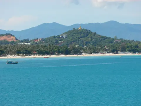
Photo: Roma Neus, CC BY 3.0, Wikimedia Commons ViewpointLad Koh Viewpoint
East-coast sea view right on ring road 4169
-
Viewpoint
Pom Mountain Viewpoint (Khao Pom)
Highest peak ~635m, central island — hard climb
-
Viewpoint
Overlap Stone
Balanced boulder viewpoint above Lamai
-

Photo: Christophe95, CC BY-SA 4.0, Wikimedia Commons ViewpointLamai Viewpoint
Hill deck over Lamai bay
-
Viewpoint
The Cocoon Viewpoint
hilltop cafe, plane-spotting over airport
-
Viewpoint
Maenam Viewpoint (View Top)
north-coast hill, view to Koh Phangan
-
Viewpoint
Giant Summit Samui
Na Muang hills, cliff balcony panorama
-
Viewpoint
Jungle 360 Viewpoint
second-highest peak, full 360 view
-
Viewpoint
Heaven Gate Samui
photo-zone hilltop, steep scooter road
-
Viewpoint
Four Seasons Viewpoint
Laem Yai hill, west-coast and Nathon view
-
Viewpoint
Beverly Hills Cafe Viewpoint
Chaweng-Lamai road, bay panorama
By difficulty of the ride up
| Easier — short access | Lad Koh (between Chaweng and Lamai, with parking by the viewpoint) and Lamai Viewpoint (a short hill above the bay; entry 100 baht). |
|---|---|
| Medium — a real climb, paved | Overlap Stone (concrete lane above Lamai, steep but short), The Cocoon (short, very steep lane up to the cafe), Four Seasons Viewpoint (steep hill at Laem Yai, west-coast view). |
| Hard — mountain roads, 125cc+ and good brakes | Pom Mountain / Khao Pom (the island's highest point, ~635 m, very steep), Jungle 360 (very steep), Giant Summit (steep road in the Na Muang hills), Heaven Gate (very steep), Maenam Viewpoint / View Top (very steep, the long climb), Beverly Hills Cafe (the nearby road is very steep; I have not ridden up to the cafe). |
When to go
- Sunrise — Lad Koh and Lamai Viewpoint face east: the sun comes up out of the sea.
- Sunset — Four Seasons Viewpoint and the west-facing cafes (Air Bar at Taling Ngam) are the island's sunset side.
- Rainy season (October–December) — the mountain roads get slick. Ride the high ones early, keep the ring-road ones for wet days.
- Heat — there is almost no shade on the summits. Water, hat, and a lid on the scooter seat so it does not burn you on the way back.
Routes that string them together
The ring road loop passes Lad Koh and comes close to Lamai Viewpoint and Four Seasons. The mountain loop (write-up coming; GPX is on the home page) takes in Jungle 360, Pom Mountain, Heaven Gate and View Top in one go — a hard half day. Lamai Viewpoint is a short add-on to any ride through Lamai; Overlap Stone is a steep concrete lane just inland.
Questions
Which Koh Samui viewpoint is the easiest to reach by scooter?
Lad Koh. It sits between Chaweng and Lamai, with parking by the viewpoint. The climb there is short.
Can a beginner ride up to Pom Mountain?
I would not. It is the highest point on the island and the road is very steep, and rough in places. Ride Overlap Stone first; if that felt fine, the mountain is the next step — in the morning, solo, on a 125cc or bigger.
Do the viewpoints charge an entrance fee?
Lad Koh has free parking beside it. Lamai Viewpoint charges 100 baht (the viewpoint, Valentine Stone and the Siva Tara waterfall; the cable car is 100 baht extra), about 9:00–18:30. The Cocoon and Giant Summit are restaurants.

Anton A.
I live on Koh Samui and have been riding the island for several years. Every road on these maps I rode myself — the track is a real GPS log. Spotted an error? Message me on Telegram: @abrameicev