Koh Samui waterfalls by scooter — Na Muang, Hin Lad, Wang Saotong (2026)
This is the waterfall day I ride from Chaweng: five falls, a jungle temple and one viewpoint, strung into a single loop through the island's interior. The map and GPX come from my own track. Below is what the stop cards do not tell you: the climbs, the order that saves your legs, and where to be careful.
Grey — every road I have ridden; colour — this route. Tap a pin for Google Maps navigation. GPX works in Maps.me, Organic Maps, OsmAnd, Garmin.
Climbs and descents
Across — kilometres from the start, up — metres above sea level; the numbers at the bottom are the stops listed below. Bars under the chart and the yellow-and-black stretches on the map mark steep sections (over 12 %, dark red over 20 %). Elevation comes from SRTM satellite data, smoothed: an estimate, not a measurement on the road.
Stops along the way
-
Waterfall
Khun Si Waterfall
Remote falls in durian plantations
Follow the GPX closely on the inland approach.
-
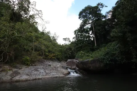
Photo: Павел Бондарчук, CC BY 3.0, Wikimedia Commons WaterfallHin Lad Waterfall
Jungle trail near Nathon, temple
Park near the temple at the trailhead and walk in, in shoes with grip.
-
Temple
Wat Namtok Hin Lat
Jungle temple at waterfall trailhead
This is a working temple, so cover your shoulders and knees and keep your voice down.
-
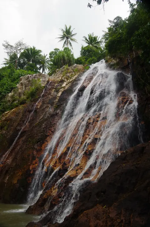
Photo: Balou46, CC BY-SA 3.0, Wikimedia Commons WaterfallNa Muang Waterfall 2
Tall upper fall, short jungle trek
Do the trek in the morning, before the heat. The path is uneven and muddy after rain.
-
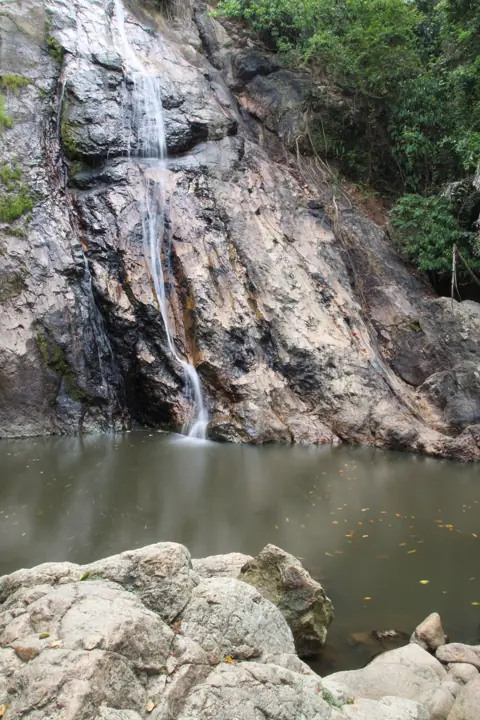
Photo: yeowatzup, CC BY 2.0, Wikimedia Commons WaterfallNa Muang Waterfall 1
Easy lower fall with a swimming pool
This is the easiest fall on the route to reach. Check the water level before swimming after heavy rain.
-
Viewpoint
Giant Summit Samui
Na Muang hills, cliff balcony panorama
The road up is short but steep. Ride down slowly with both brakes.
-
Waterfall
Wang Saotong Waterfall
Quiet falls near Lamai, short hike
On the mapped loop, this comes before Giant Summit. Leave enough daylight for the ride back.
The ride in numbers
| Distance | 69.3 km from Chaweng and back, exactly as in the GPX. |
|---|---|
| Riding time | About 2 hours of riding at 35–45 km/h. The side roads to the falls are slower than the ring road. With the walks, a swim and the viewpoint, this takes a full day. I leave by 9. |
| Road | The route has steep and very steep climbs and descents, with about 1,870 m of climbing overall. Level: medium. |
| Scooter | A 125cc automatic. A 110cc will get there, but it labours on the Na Muang hills with a passenger. More on that in 50cc or 125cc. |
| Direction | Inland and north-west first (Khun Si, Hin Lad). Then south to Na Muang, and home through Lamai. The last leg is short, and it comes when you are tired. |
Where to be careful
- On foot, not only on wheels. Rocks at the falls are usually wet. Wear sandals or shoes with real grip. Flip-flops are how people get hurt here.
- Rain season, October to December. The falls are at their fullest, and the trails are at their muddiest. After heavy rain the water can rise fast. If it is brown and fast, do not swim. See rain and night riding.
- Light. Leave time for the inland roads in daylight. Plan to be back on the ring road before dusk.
- Papers and helmet. Wear a helmet. Tourists need a national motorcycle licence together with a 1949 IDP showing category A, for stays of up to about three months; longer stays require a Thai licence.
- Valuables. You will be away from the scooter during the walks. Take documents and your phone with you.
How to ride it, stop by stop
- Khun Si Waterfall. The first stop, inland from the north coast through plantation lanes. Keep the GPX open for the turns inland. It is quiet, a good fall to start the day.
- Hin Lad Waterfall and Wat Namtok Hin Lat. These are near Nathon. The temple sits at the trailhead, and the jungle trail starts there. Cover your shoulders and knees for the temple. The walk length is worth checking with whoever is at the entrance.
- Na Muang Waterfall 2, then Na Muang Waterfall 1. I do the upper fall first, while my legs are fresh, because it needs a walk through the jungle. Then I drop to the lower fall, which has a pool for a swim.
- Giant Summit Samui. This viewpoint is in the same Na Muang hills, a short and steep ride away. It makes a good break after the swim. More viewpoints are on the viewpoints route.
- Wang Saotong Waterfall. Visit before Giant Summit if you are following the loop in its mapped direction. The approach includes very steep sections.
GPX and navigation
The GPX above is cut from my own GPS log, so the turns into the plantation lanes are exactly where I made them. You can import it into Organic Maps, OsmAnd, Maps.me or a Garmin. Download the offline map before you leave, because in my experience mobile signal in the interior can be weak. Google Maps does not open GPX files. For Google, tap a stop on the map and use Directions for each leg.
Fill the tank before you leave the ring road. Some of the climbs are long.
Questions
Can I get to Na Muang waterfall by scooter?
Yes. Na Muang 1 is easy to reach and has a pool. Na Muang 2 needs a walk through the jungle after you park. A 125cc handles the climbs better than a 110cc.
Is there an entrance fee at the waterfalls?
Some falls may charge for entry or parking. Amounts change, so check on site and carry some cash.
When are Koh Samui waterfalls at their best?
From October to December the falls have the most water, but the trails are slippery. In drier months smaller falls can thin out. Mornings are cooler for the walks at any time of year.
Is this route OK for a beginner rider?
It is rated medium, but the full loop includes many very steep climbs and descents. The approaches around Na Muang also include very steep sections, so this is not a good first scooter ride.

Anton A.
I live on Koh Samui and have been riding the island for several years. Every road on these maps I rode myself — the track is a real GPS log. Spotted an error? Message me on Telegram: @abrameicev