North coast of Koh Samui by scooter — Bophut, Maenam, Bang Por, Nathon (2026)
The north coast route follows the 4169. Bophut, Maenam and Bang Por look across the water to Koh Phangan, and the ride ends at Nathon, a ferry town. This is the ride as I do it from Chaweng: east to west, 27.2 km, with the sunset at the far end.
Grey — every road I have ridden; colour — this route. Tap a pin for Google Maps navigation. GPX works in Maps.me, Organic Maps, OsmAnd, Garmin.
Climbs and descents
Across — kilometres from the start, up — metres above sea level; the numbers at the bottom are the stops listed below. Bars under the chart and the yellow-and-black stretches on the map mark steep sections (over 12 %, dark red over 20 %). Elevation comes from SRTM satellite data, smoothed: an estimate, not a measurement on the road.
Stops along the way
-
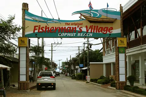
Photo: Ralf Schmidt, CC BY-SA 3.0, Wikimedia Commons AreaFisherman's Village (Bophut)
Old town, walking street, Friday market
Park on the main road or a side street before the walking street; on Friday evening expect the street itself closed to scooters.
-
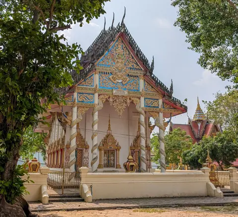
Photo: Vano111ru, CC BY-SA 4.0, Wikimedia Commons TempleWat Bophut Tharam
Serene temple in Bophut north
-
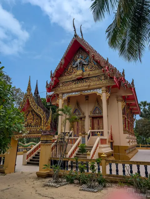
Photo: Vano111ru, CC BY-SA 4.0, Wikimedia Commons TempleWat Na Phra Lan
Temple by Maenam pier, north coast
-
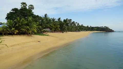
Photo: Fabio Achilli from Milano, Italy, CC BY 2.0, Wikimedia Commons BeachMaenam Beach
Long quiet north-coast beach, Phangan views
-
Area
Maenam Walking Street
Thursday night market, central Maenam
-
Beach
Bang Por Beach
Secluded north-coast beach, local seafood
-
Area
Laem Yai
Westernmost cape, quiet seafood spot
-
Viewpoint
Four Seasons Viewpoint
Laem Yai hill, west-coast and Nathon view
Short steep climb from the coast road. Go in dry weather in the late afternoon, and check on site that the viewpoint is open.
-
Area
Nathon Town & Walking Street
Island capital, Saturday night market
-
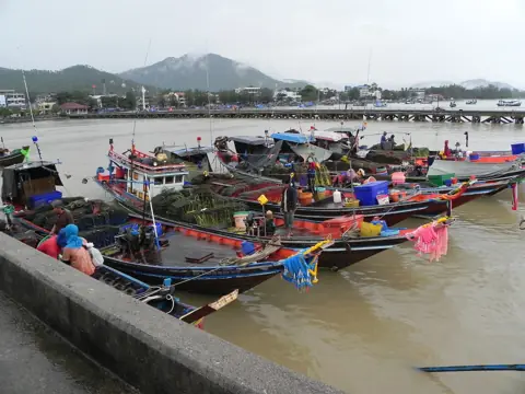
Photo: Hajotthu, CC BY 3.0, Wikimedia Commons AreaNathon Pier
Songserm/Lomprayah ferries to mainland
If you are catching a ferry, check the current timetable at the pier office, and allow for traffic in town.
The ride in numbers
| Distance | 27.2 km from Chaweng to Nathon Pier as mapped in the GPX. Some stops require separate detours, including Wat Na Phra Lan and Maenam Beach. |
|---|---|
| Riding time | About 40 minutes non-stop at a relaxed 40 km/h, one way. With two temples, a beach and lunch, it is an easy half day. Add a night market and it becomes a full day. |
| Road | Mostly the coastal 4169, with one short steep section near Laem Yai. Near Four Seasons Viewpoint the main road has four lanes. |
| Scooter | Any 110–125cc automatic is enough. Check your fuel before leaving; there is a petrol station near Nathon town. |
| Direction | East to west, Chaweng to Nathon. You reach the west-facing end of the island in the late afternoon, which is the right time for the viewpoint. |
Where to be careful
- Fisherman's Village, Bophut. Watch for pedestrians and parked cars. Park before the walking street if it is closed for the market.
- Maenam. Side roads join the 4169 from both sides, and cars U-turn across it. Slow down at junctions, especially on Thursday market night.
- Nathon. Watch for ferry traffic near the pier and leave room for songthaews to stop.
- After dark. Check your headlight before leaving. If you stay for sunset, ride back slowly. More on this in riding in rain and at night.
How to ride it
- Fisherman's Village (Bophut). A short ride from Chaweng. In the morning the street is empty and quiet. Friday evening is market night.
- Wat Bophut Tharam. A few minutes away, and calm. Cover your shoulders and knees.
- Wat Na Phra Lan. Next to Maenam pier, just off the coast road.
- Maenam Beach and Maenam Walking Street. A long, calm beach facing Phangan, and a good place for a swim and lunch. The walking street is the Thursday night market. All the Maenam stops are within a few kilometres of each other, so take them in whatever order is convenient.
- Bang Por Beach. Quieter than Maenam, with seafood by the water.
- Laem Yai and Four Seasons Viewpoint. The western cape and the hill above it, looking down the west coast towards Nathon. Late afternoon is the best time.
- Nathon Town and Nathon Pier. A ferry town with a walking street. Passenger boats to the mainland leave from the pier; it is not a car ferry pier.
GPX and getting back
The GPX comes from my own GPS log, so it follows the turns exactly as I rode them. It works offline in Organic Maps, OsmAnd, Maps.me or on a Garmin. Google Maps does not open GPX files. If you use Google, tap a stop on the map and use Directions.
The simplest way back is east along the same 4169 to Chaweng. Expect about an hour without stops. If you would rather make a loop, continue south from Nathon along the west coast on the south-west route. The two routes together cover most of the ring road.
Questions
Is the north coast of Koh Samui good for a beginner on a scooter?
Yes, the route is rated easy, with one short steep section. The main road near Four Seasons Viewpoint has four lanes. If you are unsure of your braking, skip the climb to the Four Seasons viewpoint.
How do I get to Nathon by scooter from Chaweng?
Follow the 4169 west along the north coast, through Bophut, Maenam and Bang Por. My track with all the stops is 27.2 km, and riding straight through is shorter.
Which night markets are on this route?
Maenam Walking Street on Thursday, Fisherman's Village in Bophut on Friday, and Nathon on Saturday. Start times vary, so check locally.
Do I need a license to ride to Nathon?
Wear a helmet. Tourists need a national motorcycle licence together with a 1949 IDP showing A for stays of up to about three months; longer stays require a Thai licence. Fines: up to 2,000 baht for no helmet and up to 1,000 for not carrying a licence.

Anton A.
I live on Koh Samui and have been riding the island for several years. Every road on these maps I rode myself — the track is a real GPS log. Spotted an error? Message me on Telegram: @abrameicev