Na Muang Waterfall 2 — the ride in and the hike up (2026)
Na Muang 2 is the upper, taller of the two Na Muang falls in the south of Samui, and the only one of the pair that makes you walk for it. This page covers how I ride there, what the jungle trail is like, and how to fit it into a day with the nearby viewpoint and the lower fall.
Grey — every road I have ridden; colour — this route. Tap a pin for Google Maps navigation. GPX works in Maps.me, Organic Maps, OsmAnd, Garmin.
Places on the map
-
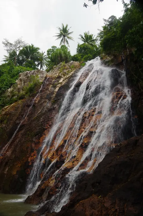
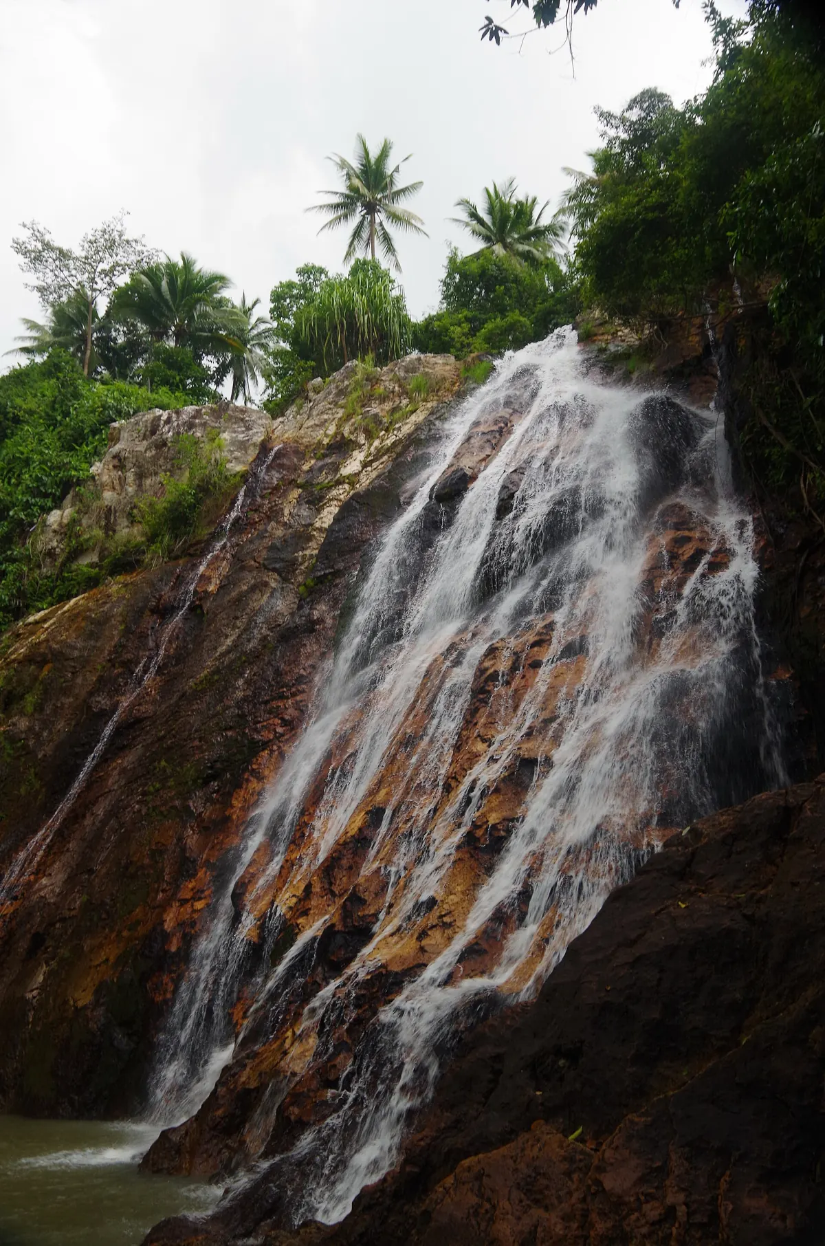
Photo: Balou46, CC BY-SA 3.0, Wikimedia Commons WaterfallNa Muang Waterfall 2
Tall upper fall, short jungle trek
Park as close to the upper fall as the road allows, and start the hike before 10 to avoid the heat.
-
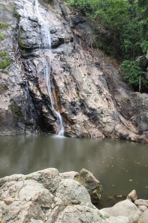
Photo: yeowatzup, CC BY 2.0, Wikimedia Commons WaterfallNa Muang Waterfall 1
Easy lower fall with a swimming pool
Next to the road with an easy pool, a good place to cool off after the climb to Na Muang 2.
-
Viewpoint
Giant Summit Samui
Na Muang hills, cliff balcony panorama
About 600 m east of Na Muang 2 in a straight line; allow for a separate, steep road approach before or after the hike.
-
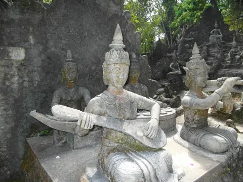
Photo: Roma Neus, CC BY 3.0, Wikimedia Commons TempleSecret Buddha Garden (Tar Nim)
Jungle sculpture park up on Pom Mountain — steep access road
The access road up Pom Mountain is steep, so skip it in rain or if you are new to hills.
Getting there by scooter
Na Muang sits inland in the south of the island, in the hills between Lamai and the west coast. From Chaweng I ride south on the 4169 through Lamai and stay on it as it turns inland. From Lamai, it is about 10 km along my route. Na Muang 2 is higher in the hills; walking access is available from the Na Muang 1 area or via the safari park. In a straight line the two falls are less than a kilometre apart, but the road between them is not straight.
The approach has very steep pitches. I would only ride it with experience on hills and a scooter in good condition, especially with a passenger. Go slowly on the way down and brake before the bends, not in them. Wear a helmet: the law requires it.
Choose your walking approach before setting off: from the Na Muang 1 area or via the safari park. If you end up at Na Muang 1, expect a longer uphill hike from there. A charge of about 100 baht is reported on the safari-park side, but reports differ; check the charge and keep small cash.
The hike and how long to stay
From the parking the trail climbs through jungle over roots, rocks and rough steps cut into the slope. Allow time for an uphill walk, depending on your fitness and how wet the ground is. Take your time coming down and watch every step.
At the top is a tall fall over a rock face, much higher than Na Muang 1, with a small pool at its base. Swim only if the water is calm and you can see the bottom. After heavy rain the current is strong and the rocks around the pool are slick.
- Wear shoes with grip. Flip-flops are not enough for this trail.
- Carry water up with you. Do not count on anything being sold along the trail.
- Plan 1.5–2 hours in total for parking, the hike, time at the fall and the walk back.
When to go
Go in the morning. By midday the climb is hot and humid even in the shade, so I prefer an early start. If you arrive by 9–10 you get a cooler walk and a quieter pool.
The rainy season, roughly October to December, is when the fall is at its fullest and also when the trail is at its worst. Mud, wet roots and slippery rock make the descent the risky part. The hill roads in and out get slick too, so after a downpour wait under cover until conditions improve before riding. In dry weather the flow can drop. The walk is easier then, but the fall is less impressive.
What to combine it with
Na Muang 2 is one of the stops on my waterfalls route, a 69.3 km ride that strings together Na Muang, Hin Lad and Wang Saotong. If you want one long day of falls, follow that route, and do Na Muang 2 first while your legs are fresh.
For a shorter half day, stay in the Na Muang hills:
- Na Muang 1: the lower fall. Swim there after the hike to cool down.
- Giant Summit: a viewpoint about 600 m east of the upper fall in a straight line, with a separate, steep road approach. It is a good stop to rest and look over the hills you just rode through.
- Secret Buddha Garden: a jungle sculpture park a little north, up on Pom Mountain. The access road is steep, so only go if you are confident riding hills, and not on a wet day.
Questions
How do I get to Na Muang Waterfall 2?
Take the 4169 south through Lamai and stay on it as it turns inland, then follow the signs for Na Muang. Choose the walking approach from the Na Muang 1 area or via the safari park; reaching the upper fall involves an uphill walk.
How long is the hike to Na Muang 2?
The walking time depends on your starting point, fitness and trail conditions; allow plenty of time for the descent too. It is steep and uneven, so wear shoes with grip and carry water.
Can you swim at Na Muang Waterfall 2?
There is a small pool at the base, and in calm conditions you can get in. After heavy rain the current and the slippery rocks make it a bad idea, and for an easier swim go to Na Muang 1.
Is Na Muang 2 worth it if I have seen Na Muang 1?
If you can manage a steep 30-minute walk, yes. The upper fall is much taller and quieter. If you cannot, Na Muang 1 gives you the waterfall and the swim without the climb.

Anton A.
I live on Koh Samui and have been riding the island for several years. Every road on these maps I rode myself — the track is a real GPS log. Spotted an error? Message me on Telegram: @abrameicev